Showing posts with label lake. Show all posts

Wednesday, May 20, 2009

Nagsasa Cove, Zambales

(photo by AllanBarredo, NIKON D50, May 16, 2009)
Nagsasa Cove (pronounced as NAG-SASA) is located further south of Anawangin Cove in Zambales. To date, this beautiful corner of Zambales is what Anawangin used to look like before they setup flags there and before the hoards of multitude invaded it resulting in bumper to bumper tents and overcrowded shores.
(photos: below left, google rendition, below right:NagsasaCove by AllanBarredo May 16, 2009)


This
cove has a visible aeta community of around 7 families or roughly 30 people. Their leader or spokesman is who we refer to as Mang Ador, a wirey fellow in his late 30s who is married to an aeta woman. Mang Ador, with the help of good hearted visitors such as Mr.Ryan Guzman, has taken it upon himself to improve his corner of this cove so as to make it camper friendly. He lives on the NORTH side of the cove while the rest of the aeta community lives on the SOUTH side. Mang Ador is not an aeta himself but hails from La Union.


THE CAMPSITE:
One of Nagsasa's features is this lake with a superb view of the mountain range. One can enjoy this scenery while cooling off in the clear waters of the lake.
(photo below:NagsasaLake by AllanBarredo May 16, 2009)
Mang Ador has already setup 5 long tables along the shoreline for campers to use. He also setup a small bahay kubo with papag for visitors. There is a handpump at the back of the campsite as well as two toilets similar in construction to those in Anawangin. Mang Ador always sees to it that all toilets have water so since we were a group of about 40(the largest he has entertained so far), he never stopped fetching water from the pumps! (poor guy!) He does not charge any fees for these facilities (yet) so we took it upon ourselves to give 100pesos per head nalang. Other groups such as that of Ryan Guzman's make it a point to bring 2 extra canned food each to leave with Mang Ador.

(CAMPSITE photos by AllanBarredo May 16, 2009)


There was an abundance of fishcatch, mainly bangus(milkfish), while we were there (due to the recent storm) so they were selling it at 40pesos per fish. These fishes weighed approximately 1.5 kilos and were really FAT and delicious. You can ask Mang Ador if he or the others have any fresh fish, they usually do, and buy them to add to your meal. Nakatulong ka na, fresh at masarap pa yung kakainin mo.

(photo below:NagsasaLake by AllanBarredo May 16, 2009)
There are many pine trees where you can tie your hammock and/or clotheslines. Since there is absolutely NO CELLPHONE SIGNAL anywhere on this cove, I suggest you turn your cellphone OFF, lie down on your hammock and let the wind rock you to sleep while you listen to the soothing sound of the birds and the waves.
(photo below:HAMMOCK central by KitLava May 17, 2009)


THE BEACH:

The beach is composed of the same volcanic sand that covers the whole zambales shoreline stretch. It gets VERY HOT during noontime so take caution to don your footwear pls.
(photo below:NagsasaCove at 6AM, by AllanBarredo May 16, 2009)
Unlike in Anawangin, the waters are very calm since the cove is very big. Also, there is a very nice snorkling area about 100meters off the campsite shore with a depth of about 20feet. I noticed a lot of coral formations as well as abundant and colorful fishes there. I do hope dynamite fishers do not touch that area.
If you happen to witness dynamite fishing then don't be afraid to speak up! Get their attention and let them know that what they are doing is wrong. Take out that nice digicam and snap away! Report them and their vessel to the local barangay. Enough damage has been done by both these people and those who condone them by their silence! After all, we deserve the environment we help create diba.


THE FALLS:

One of Nagsasa Cove's special features is this beautiful cascading waterfalls that can be reached via a 30minute leasurely hike to the south of the campsite. You can ask Mang Ador or one of his fellows to guide you to the falls. Just give the guide a small tip (50pesos or so) afterwards. The waters are clean and clear due to the fact that settlers are forbidden to take residence upstream.


(photos courtesy of KitLava, May 16, 2009)
TIP: Go up just a bit higher along the cascading falls and sit in one of the larger crevices. You get to view the mountain range while cooling down as if you were in your own private INFINITY POOL.


HOW TO GET THERE:
(photo by Allan Barredo, May 16, 2009)
Its pretty much the same as going to Anawangin. Only the boat fare and distance from Pundaquit to Nagsasa cove is greater. We used our usual boatman Mang Vic. His boat is quite big so 10 of us were able to fit in it. Our gear, however, had to be loaded on a smaller boat. The big boat charge was 3k and the smaller boat charge was 1.2k so thats about 420pesos per head.
Mang Vic will soon be using his new boat which is big enough to hold 25 passengers so please call him if you have a large group. His number is still +639297170739. He can also buy mineral water for you and lend you containers for them.
We arrived in Pundaquit in the wee hours of Saturday morning, at 2AM, and were able to leave for Nagsasa at 3AM. Since it was such an ungodly hour, I'm really grateful that Mang Vic was so accomodating. I didn't hear a word of complaint from him!
You can apply the Anawangin sample itinerary and costings found in my old blogs for Nagsasa.


PARKING:
Numerous parking areas have sprung up in Pundaquit so parking should not be a problem. The normal parking fee charge there is 100pesos per night. Make sure your vehicles are secure and all parking lights are off when you leave it.


CAUTION1: SANDFLY ALERT!
The (rocky area)northern tip of Nagsasa beach has sandflies. If possible, avoid this area during sunrise and sunset. If you need to go to this rocky area during these time periods consider taking VitaminB first or putting some Citronella Oil as suggested in this site.


CAUTION2: CROWN OF THORNS
The coral area in Nagsasa has a number of C.O.T. starfishes. DO NOT TOUCH the thorns! It releases a neurotoxin that can cause a sharp stinging pain lasting hours, as well as nausea and vomiting. For more information on COTs please click here.
Divers who plan to go to Nagsasa please bring large thongs and sacks(or sodium bisulfate injections) and volunteer some of your time to remove a few of these and bury in the sand. During low tide, the COT locations are shallow enough to reach and extract safely without dive gear. DO NOT CUT OR DAMAGE them during extraction as this will (supposedly) cause them to release eggs thereby aggravating the situation even further. Thanks


Visit my friend's blog by clicking this link (AllanBarredo's LANTAW blog) to see more of his exemplary photographs of Nagsasa Cove and read his writeups.

Sunday, March 09, 2008

Anawangin Cove, Zambales

Anawangin Cove, Zambales Jan, 2008

Its been a while since I updated this travel blog. Not that I've stopped travelling but because I just can't find the time to organize both my thoughts and the images I took. Besides, things have been really crazy lately especially with my moving to a new house and the usual year-end schedules. I've been to a number of interesting places but I'll start with the most recent one since its what is most fresh in my mind. Anawangin cove.

(photo: Capones Island and Pundaquit shore)


I noticed this cove back in 2005 while looking for places to go. The cove looked promising even at low res then. It looked even better when they upgraded the image to hi-res! One could clearly see a couple of lakes and what clearly were not coconut trees.

Google Earth lists a different name for the cove, something like Galaguagin Cove?... but I can't recall it right now. The cove lies just a bit south of Pundaquit, Zambales.

(photo: Pundaquit resort tables where we slept while waiting for dawn. The boatman, Mang Vic, let us use it for free. Call him at +639297170739 to reserve. Also, there's parking available! see rightmost image, you can see a car parked at the back)


Unsure about parking, we decided to go there by bus. To get the most out of the weekend, we left manila on the 11pm Victory liner bus from Caloocan.

Our itinerary looked like this...

開始: 2008/01/12
終了: 2008/01/13
場所: Bgy. Pundaquit, San Antonio, Zambales
ITINERARY - ANAWANGIN and CAPONES ISLAND

Day 1 - January 11 Friday

1030 PM Assembly Victory Liner Caloocan
1130 PM ETD San Antonio, Zambales via Iba-bound Bus
http://www.victoryliner.com/tripschedules1.htm

Day 2 - January 12 Saturday

0230 ETA San Antonio, Zambales/ board trike to Bgy. Pundaquit
- eat some goto sa gotohan dun sa kanto
0330 ETA Pundaquit, Zambales, makitulog sa resort ni manong
0730 Board banca to Anawangin, side trip to Capones Island
- can't get to the lighthouse kasi low tide, balik ulit bukas
0900 Arrived at Anawangin Cove/ Set Camp, tulog ulit?
1230 LUNCH
1400 EXPLORATION / SWIM / FRISBEE / BOOMERANG / PICS
1900 DINNER and Socials

Day 3 - January 13 Sunday

0630 Wake Up/ Prepare Breakfast
0730 BREAKFAST
0800 Swimming Swimming Explore Explore
1300 Break Camp
1400 Board boat for Capones Island
- took pics of lighthouse
1530 Leave Capones for Bgy. Pundaquit
- get a tricyle to SanAntonio
1630 Get regular bus to Olongapo Victory Liner
1800 Depart for Manila (victory liner olongapo)
2130 Arrived at Balintawak

=NOTES=

1) Bring goggles and/or your snorkel set!
2) Bring a hammock, if you have one
3) Secure provisions before the trip. Remember, there's no electricity in
the area :)
4) There's a water source at the campsite that's good for cooking and
washing. Bring drinking water though.
5) The last bus at Victory Caloocan leaves at 11:30PM so DON'T BE LATE!!!
6) bring a thin blanket. VERY USEFUL sa bus and in the tent

=PROJECTED EXPENSES=

P219.00 x 2 = Bus from Pasay to San Antonio, Zambales and back
P40.00 x 2 = Tricycle from Bgy Pundaquit and back
P1800.00/5 people = Round trip boat fare plus 2 side trips to Capones
(360@pax)
P300.00 = Food and Provisions

Estimated Budget: 438 + 80 + 360 + 300 = P 1,178 pesos@pax


We arrived at San Antonio before 3am. Tricycle drivers IMMEDIATELY approached us and offered a ride to Pundaquit. DO NOT agree to their 100@tricycle offer and insist on 80pesos only. We were a group of 5 so we had to get two tricycles.

BUT FIRST... kain muna tayo ng GOTO!


Hindi masyadong malasa yung goto pero mainit naman. And remember, this was at 3am. Meron din fried rice and sisig so chibog muna kami lahat.

While eating, I found out that the market does not open until 7am. I was surprised and asked why since I am used to Balintawak Market which opens at 4am - ang sagot? "Eh wala ka naman sa Maynila eh!" - fine... mga tamad ang tao sa probinsiya. And I always thought these people woke up early... baka napupuyat din kaka DOTA? not...


Anyway, in a pinch, I agreed to giving the tricycle driver some money to get supplies for us while we take a little nap in pundaquit. I gave the guy 700 pesos to get a few kilos of pork, a 5 gallon mineral water, some rekados, charcoal, ice and kerosene. The chap was nice enough to lend us his icebox!

He brought us to Pundaquit and introduced us to our boatman Mang Vic(+639297170739). The regular small boats(1.2k balikan) could probably hold 4 small people with a few gear but not 5 huge guys with 2days worth of supplies and equipment. We settled on 1.8k for rental of his big boat with a trip to Capones Island on the side. Pretty good deal I think. It's certainly a lot cheaper than what those bancas in Anilao would charge.

As expected, the tricycle driver ran late and arrived past 7am already. We visited Capones Island but was not able to go the farside because of the low tide. We just walked around the shore and took some pictures before traversing the 6kilometers or so trip to Anawangin cove from there.

(photo: Capones Island, east side. Notice the strange rock formations, leftmost photo)


I was stunned by the beauty and tranquility of Anawangin cove.
Not only was it cool because of the pine tree forest, the scenery was fantastic. The water, although painfully lacking in marine life and corals, was calm, clear and comfortable. PLUS your eyes are treated to this wonderful encompassing view of the hills and tree forrest.

(photo: setting up camp, checking supplies)


I setup my hammock, mixed a cold alcoholic drink and relaxed. No sound but the wind and the sea - THIS IS THE LIFE!


The next day we decided to go and find the water source at the base of the mountains. I thought it was about half a kilometer from the camp but in reality it was about 3 kilometers east of the campsite. Needless to say we gave up before we found this water source. The local Aeta we met, mang danny, was friendly enough to guide one of our lost companions to safety and confirm its existence. He also helped avert danger by bringing our attention to the numerous snakes that came across our way.

(photo: river ran through this, careful! Watch out for snakes ! -rightmost image)


(photo: nice toilet, friendly native, poso!)


Anawangin cove is unique in that it has both fresh water lake river and saltwater shore side by side. The small hills that surround are safe and ideal for climbing. The scenery it offers after the climb is often too much a reward for the effort.


We packed our stuff and headed to the lighthouse at Capones island for some quick pics. Then off we went back to our insignificant lives in Manila. All in all another excellent vacation!


(photo: capones island light house, gate and final farewell to pundaquit shores)


More images of Anawangin here ALLAN'S FLICKR
and more stories here ALLAN'S BLOG

Friday, May 12, 2006

cursed rains, blessed relief (Caliraya, Laguna)

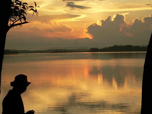
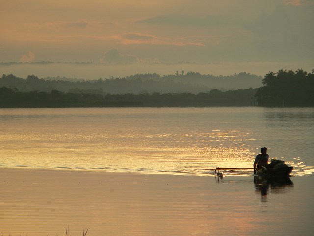
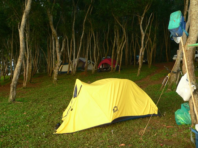
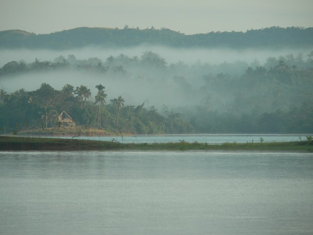
I've just checked on the progress of typhoon Caloy. It seems to be passing over Manila as I write this. Sadly, summer in the Philippines is almost over I guess. I hear its met with mixed feelings as it gives manilenos a respite from the heat even if all those last minute vacationers are forced to stay home and sit this weekend out. It looks like its going to rain here in Tokyo tomorrow as well. Cold weather with some rains remind me of that wonderful camp site in Caliraya Lake. I've been going there a lot these past few years. I know it always rains there and its always windy but I really like this camping ground called Eco Saddle. I've gotten to know the main caretaker Mr.Benz Abenonar. He's a stocky fellow whom I believe actually cares deeply for the environment. I'd like to take one of his eco tours where you hike up for 4hours or so up one of the mountains closeby. Of course, I'd have to get in good shape for this as we are to bring all the camping gear by foot to and from the campsite in these mountains. (photos taken from Eco Saddle, Caliraya Lake 2005/07/31 -- upper left: Takai and mom, right: Allan-dawn on the lake, lower left: man selling black bass, lower right: 7am and most are still asleep)


I like this campsite because even if the toilets really suck (hey, this is the outdoors right?) the sight and smell and sound of nature all around is really invigorating. Waking up to the sound of birds chirping is theraputic at the least. The constant rustling of leaves and this cool breeze on my face lets me forget all the stench and despair of manila. Here, you bring your cooler, sit and down a couple of beers, swim a little and cook some barbeque over some hot charcoals. You can request the staff to bring wood for a bonfire. They charge you 150 for the wood and they would even light it up for you at your desired time. The best time to go is definitely during summer. Early March is best as the wind is cool and the ground dry. The water also recedes much further during this time and so you have a greater area to walk around on or play with your family or friends. There is a whole lake you can dip into when you feel hot but for those who don't feel like walking around on the soft mud that makes up the lake floor, you can opt to take a shower in the shower stalls beside the toilets. We always bring our bikes so that some can go around the lake or visit the Japanese gardens if they wish. Kulang ulam niyo? No problem, just go out and buy some black bass or tilapiya from the many sari-sari stores that line up the road.

(photos taken by Francis Atendido in Eco-Saddle Caliraya lake using a Panasonic Lumix FZ-20 2005/07/31 left: morning mist - view from eco saddle)


Eco-Saddle in Caliraya lake truly is a great place to bring friends or family. Just respect other people's rights to a quiet weekend and stop using your car boombox in this camp. After all, we're all after some peace and quite here right?

Tuesday, May 09, 2006

Stampang Bato (Wawa, Rizal)

I've been aiming to chronicle another trip we had this summer. I should do so before the details slip my mind. The mind is a fickle thing. I remember my highschool teacher quoting "the palest ink is better than the most retentive memory" to me one time. Back then computers were for large companies who could spare "buildings" in which to house a machine equivalent to less than a Pentium I with 24kilobyte memory. Its really crazy how fast the industry has progressed.

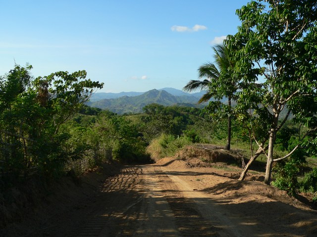
(photo: road to kasili from pintong bokawe taken by FrancisAtendido Panasonic Lumix FZ-20 2006/04/22)


I was watching this lesson on rivers featuring one of our local veins somewhere in Mindanao. I commented on how beautiful and clean it was to which George said there was a river like that not far from manila. It turns out it was in Rizal. So a little google earth and some help with my garmin GPS and off we went with our camping gear.
With all the gear we packed it would be impossible to make the 3hr hike from wawa dam so I looked for a way to get to the site by car. Fortunately there was a new road from a little known town called Pintong Bokawe. I found this town's GPS coordinates via the net and made a beeline for it while the rest of the group hiked to the site. Looking at just my coordinates to see if I'm getting warmer or colder... I was led to a place called Timberland. It looked like a private housing development but I asked the guad if I could pass through it going to Pintong Bokawe.

Luckily, they just looked at my drivers license, logged me and let me pass. There is a rough road through Timberland to Pintong Bokawe after all. The rough road will terminate to a cemented road. Take this road for about 4 kilometers until you see a turn to the left (also cemented). Take this turn and just ask around for directions to Pintong Bokawe. The road from pintong bokawe to the river via Kasili town is rough but the scenery was awesome! Kudos to Capitan Danilo of Pintong Bokawe for his staunch efforts in creating that road.
We left the car beside the river and proceeded to hike the 1 kilometer or so upstream to stampang bato. Montalban river is fed by two veins. Unfortunately one of the veins (locally called pormos river) passess through a large piggery farm owned by another chinese conglomerate. Needless to say they've really been fouling it up. One must go upstream of the unpolluted vein to reach stampang bato. Once there, unsatisfied with the depth of the waters immediately infront of the famous stone (incidentally, its a stone where vague religous images appear to have formed in a circular stains on the stone) we headed a few hundred meters more upstream and found what we were looking for. Thankfully some kind soul erected a huge nipa shed in which we decided to establish camp. Apparently it was used for activities during the past holy week.
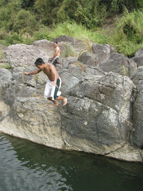
(above left: Neil testing the waters taken by FrancisAtendido , Right: Owen kamikaze jump taken by AllanBarredo , Lower Left: dusk taken by AllanBarredo Olympus Camedia C4040Z 2006/04/22)


We brought two 35liter coolers packed with ice but unfortunately one fell and displaced all its contents over the river. Too bad, we'd have to make do with one.

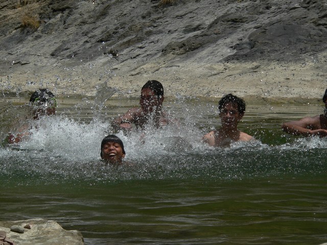
The water was clear! And it felt really good to dip in it especially with the hot summer sun over our heads. Another hundred meters upstream was an excellent 15 feet deep portion with huge rocks where you can jump from. It was awesome! Everybody took turns jumping into the clear waters from the surrounding rocks.We headed back towards our campsite at dusk.


One of the team brought his uncle along who expertly caught some small crabs(talangka) and fresh water fish which we cooked for dinner.
We talked with the family who made the shed we were using that night during dinner. We learned that this whole area was covered with huge narra and mulawin trees not long ago. Rampant logging reduced it to pitiful coverings of bamboo and small bushes. I also learned that this was still going on. People hire some kids in wawa to bring the logs downstream, a work that I surmise is very hard as they have little to eat, always wet so fungus grows on their feet, and always tired as they often have to lift some portions over the obstacles in the river.
(photos, upper right:fishes caught ready to be cleaned, upper left: me waiting for dinner while plucking a few songs, lower right: dinner's almost ready, all photos taken by FrancisAtendido 2006/04/22)

Besides being an illegal trade, these kids are taken advantage of and paid a pittance. It bothers me that just a week ago, according to our guest, a congressman with his ever present aides has just been there hunting deer. They had caught 2 and gave some of the meat away. All these people do is take take take from nature and never a thought to giving back. I find it good to learn all these things from people who actually see it. Often times I, like most of manila's work force, tend to see only whats in front of me like horses with covers beside their eyes. We awoke early the next day to a lot of birds chirping and diving around. Hundreds of them catching insects! The sight was truly majical, like a national geographic or a BBC documentary right before our eyes!
(photo, left: campsite at dawn, lower left:horsing around, taken by FrancisAtendido 2006/04/23)


Alas, It was time to packup and leave for manila. However, the waters enticed us to stay a bit longer than what our food supply allowed so thats just what we did and ate the leftover from breakfast and some fruits just to enjoy the waters for a bit longer. We brought snorkling gear and used it to watch the fish underwater. Everyone was enjoying themselves so much that time quickly passed and it was past noon before we could regain our senses and packup our stuff in preparation for the trek back to civilization. This adventure to Stampang Bato was definitely worth the effort. I will definitely go back there next summer. Hopefully we'll be better prepared to stay longer then.
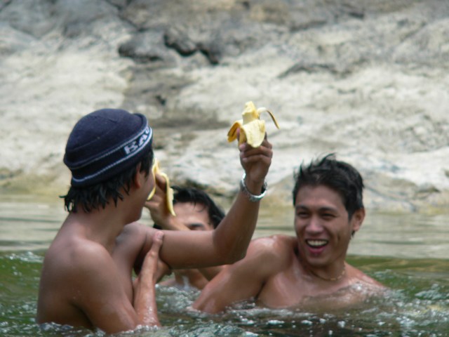
(photos , upper right: George, Neil and Owen in a light moment taken by Francis Atendido 2006/04/22, left: road towards Kasili, then to Pintong Bokawe and home taken by AllanBarredo 2006/04/22)